
- /
The Big Sur Corridor: Land, Views, and What Buyers Need to Know

The stretch of Highway 1 south of Carmel is one of the most recognizable coastlines in the world. The road drops from the Carmel Highlands bluffs, threads past Point Lobos, and opens onto the cliffs and canyons of the Big Sur coast — forty miles of coastline between the southern edge of the Monterey Peninsula and the Esalen Institute, where redwood canyons meet the Pacific and the nearest traffic light is an hour away.
Buyers who are drawn to this corridor are drawn to something specific: land in a setting that cannot be replicated, at a distance from the Peninsula communities that creates a fundamentally different ownership experience. Properties along and near the Big Sur corridor exist on their own terms. They are not vacation homes in the conventional sense. They are a category unto themselves, with regulatory, logistical, and financial realities that buyers need to understand before they fall too far in love with the view.
What the Corridor Actually Is
The Big Sur coast is not a city, a town, or an incorporated municipality. It is a collection of communities, ranches, and private parcels strung along Highway 1 through unincorporated Monterey County, governed by a patchwork of county zoning, California Coastal Commission jurisdiction, and in some areas, Big Sur Land Trust conservation easements that limit what can be built or changed.
The communities most buyers encounter when searching the corridor include Carmel Highlands, which sits just south of Point Lobos and technically falls within the Big Sur coast planning area despite its relative proximity to Carmel; the Big Sur valley itself, centered around the Pfeiffer Big Sur area and the Big Sur River corridor; and the properties between them that front Highway 1 or sit on the ridgelines and canyons accessible from it.
The Coastal Commission's jurisdiction over the entire corridor is extensive and active. Any development, addition, or significant improvement to a property along the Big Sur coast requires Coastal Commission review if it is not exempt under the county's Local Coastal Program. The Commission's standards for the Big Sur coast are among the most protective in the state, reflecting the area's designation as a critical coastal resource. Buyers who are purchasing with renovation or development intentions need to understand that timeline and cost of regulatory approval here are not comparable to what they would encounter on other California coastal properties.
The Land: What Buyers Are Actually Buying
Properties along the Big Sur corridor vary enormously in what they offer and what they constrain. Understanding the distinctions between property types is the first step in evaluating whether a specific parcel matches what a buyer actually wants.
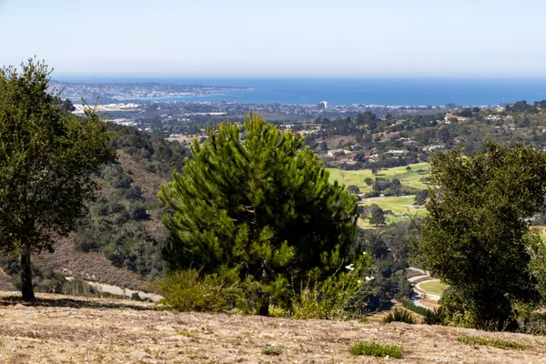
Highway 1 frontage properties: The most dramatic views on the corridor belong to properties that front Highway 1 directly, where the road traces the cliff edge and the Pacific fills the horizon. These properties offer unobstructed ocean exposure and the visual drama that defines the Big Sur coast. They also sit on a state highway with significant tourist traffic, which affects the experience of the property during the peak season months and in some cases limits access and development potential along the highway frontage.
Canyon and ridgeline parcels: Many of the corridor's most private properties are accessed by unpaved roads that climb away from Highway 1 into the canyons and on the ridgelines above them. These properties trade the highway's drama for seclusion, with some offering ridge-top views that extend over the coast from an elevation that the highway properties cannot match. Access is the defining variable: a ridgeline property accessed by a private road that is not maintained by the county is a different ownership proposition from one with paved access, particularly in winter when the Big Sur canyons can receive significant rainfall and unpaved roads become impassable.
Big Sur valley floor: The valley floor along the Big Sur River offers a different character from the coastal cliff properties — redwood canopy, river access, and a microclimate that is cooler and more sheltered than the open coast. These properties have their own regulatory environment, their own wildfire risk profile, and their own access considerations, and they attract buyers whose interest is in the valley's specific character rather than ocean frontage.
Carmel Highlands: The Highlands sits at the northern edge of the Big Sur coast planning area and functions as a transition zone between the Monterey Peninsula communities and the open coast. It offers proximity to Carmel and the Peninsula's services while delivering the coastal bluff character of the Big Sur corridor. The 2024 Monterey County STR ordinance banned new commercial short-term rental permits in Carmel Highlands, which affects the financial thesis for buyers who were considering rental income as part of the acquisition rationale. The Coastal Commission's jurisdiction applies throughout the Highlands, and the area's fire risk is significant given its cypress woodland and coastal scrub vegetation.
A Big Sur corridor property is not a vacation home with a view. It is a land ownership experience with its own regulatory environment, its own access realities, and its own relationship to the outside world. Buyers who understand that before they make an offer are in a fundamentally different position from those who discover it during escrow.
Regulatory Realities Every Buyer Should Understand
The California Coastal Commission: The Coastal Commission has authority over development in the coastal zone throughout the Big Sur corridor. This means that additions, new structures, grading, vegetation removal, and changes to access or drainage may require a Coastal Development Permit in addition to county building permits. The Commission's review process is thorough, can extend over months or years for complex projects, and may impose conditions that significantly affect what a buyer intended to build or change. Buyers with specific development plans should have those plans reviewed against the applicable Local Coastal Program policies before making an offer, not after.
Big Sur Land Use Plan: The Big Sur Land Use Plan, adopted as part of Monterey County's Local Coastal Program, establishes the land use policies that govern the corridor. It limits residential density, protects viewsheds, regulates the removal of native vegetation, and in some areas restricts the size of structures that can be built or added. The plan's protections are intentionally stringent. They are also the reason the Big Sur coast looks the way it does, which is the reason buyers want to be there.
Water availability: Water is a genuine constraint along portions of the Big Sur corridor. Properties served by private wells are subject to the limitations of the underlying aquifer, which in drought years and during the dry season can be affected. Properties in the Big Sur valley have access to the Big Sur River as a source but are subject to the same regulatory framework. Buyers should confirm the water source, the adequacy of existing supply, and any applicable restrictions before purchasing a property on which they intend to add a structure or expand use.
Short-term rental restrictions: The 2024 Monterey County STR ordinance specifically banned new commercial short-term rental permits in Big Sur and Carmel Highlands. This is not an area where buyers can assume that vacation rental income is a viable financial strategy for a newly purchased property. Non-commercial homeowners may rent their property a maximum of three times per year under the current rules. Buyers whose financial model depends on short-term rental income should understand this constraint before making an offer.
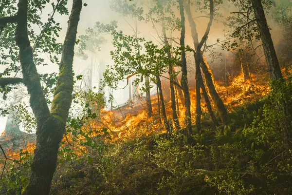
Fire risk: The Big Sur corridor has significant wildfire history, and the 2020 Dolan Fire burned portions of the coast and canyon lands south of Big Sur village. Properties along the corridor sit in high and very high fire hazard zones under CAL FIRE's 2025 map updates. Insurance availability for properties in this area requires investigation before purchase, and the FAIR Plan is a realistic outcome for many corridor properties. Defensible space requirements and the maintenance obligations they create are a standing cost of ownership here.
Access and the Logistics of Ownership
The Big Sur corridor's isolation is its defining quality and its most significant practical challenge. Highway 1 is the only road in and out for most of the corridor, and it is subject to closure. The 2017 Mud Creek landslide closed Highway 1 for fourteen months. The 2021 winter storms produced additional closures. When the highway closes, properties south of the closure are accessible only by helicopter or boat. This is not a remote hypothetical — it has happened repeatedly, and buyers who intend to use a Big Sur property as a primary residence or for extended stays should plan accordingly.
The distance from medical facilities is material. The nearest hospital is Community Hospital of the Monterey Peninsula in Monterey, roughly an hour from the Big Sur valley under normal conditions. For buyers with health considerations or who are planning for aging in place, the distance to emergency services is a relevant factor.
Contractor availability and cost on the Big Sur corridor is substantially higher than on the Peninsula. Tradespeople who are willing to travel to the corridor charge accordingly. Materials have to be transported over Highway 1, which limits what can be delivered and when. A renovation project that would take four months in Carmel can take eighteen months on the corridor, and the cost differential is significant. Buyers who are purchasing a property with renovation in mind should obtain preliminary cost estimates for the specific work they are contemplating before closing, not after.
Who This Is For
The Big Sur corridor attracts a specific buyer. It is not for someone who wants the lifestyle of the Monterey Peninsula with a more dramatic backdrop. It is for someone who wants something genuinely different: a relationship with a landscape that is largely undeveloped, a degree of separation from the world that the Peninsula communities cannot provide, and a property whose character is defined by the land rather than by its proximity to town.
The buyers who are most satisfied with corridor properties are those who came into the purchase with clear eyes about the regulatory environment, the access realities, and the maintenance obligations, and who found that those constraints were an acceptable price for what the land offers. The buyers who are least satisfied are those who discovered those constraints after closing.
This is also not a property category where the financial model looks like a conventional Peninsula purchase. The carrying costs — insurance, access road maintenance, well maintenance, property taxes, and the higher cost of any contractor work — are real. The appreciation profile of Big Sur corridor properties is driven by land scarcity and the irreplaceability of the setting, which has historically produced strong long-term returns for patient owners. It is not a category for buyers whose financial plan requires near-term liquidity or rental income to support the carrying costs.
Before You Make an Offer
The Ruiz Group works with buyers who are considering the Big Sur corridor and brings the same pre-offer diligence to these properties that we bring to every Monterey Peninsula transaction. That includes confirming the applicable regulatory framework for the specific parcel, identifying water and access constraints, investigating insurance availability, and providing a realistic picture of what ownership actually looks like before a buyer falls in love with the view and signs a contract.
If you are evaluating a Big Sur corridor property, the conversation worth having is before the offer, not during escrow. Contact The Ruiz Group to discuss what the due diligence process looks like for the specific property you are considering.
Regulatory frameworks along the Big Sur corridor are subject to change. Coastal Commission policies, county zoning provisions, STR ordinances, and fire hazard designations should be verified against current standards for any specific parcel before purchase.
Related reading: The Carmel Highlands: Area Overview · Fire Insurance on the Monterey Peninsula · What the Coastal Commission Reviews (and What Triggers It) · Short-Term Rental Rules on the Monterey Peninsula
Categories
Recent Posts





GET MORE INFORMATION
